
A Sample Joe Web Site Design Project
From Concept to Completion


Thumbnails of the many sites we've designed
Over the past 30 years, we've built or improved hundreds of websites for businesses of all sizes and industries. While each project is unique, every successful site follows a proven formula:
- Clearly communicate what makes the client unique--their products, services, or story.
- Identify the right audience and what motivates them to act.
- Design and develop pages that deliver the information customers are searching for and drive measurable results.
The following is a step-by-step walkthrough of a typical Joe Web website design project--built for great user experience, strong search engine rankings, and solid return on investment.
Is Your Current Website Too Complicated?

If so, meet No Stress CMS. It's a simpler way for small businesses to manage their websites.
Unlike WordPress (with its constant updates and security risks) or rigid DIY builders like Wix and GoDaddy, No Stress CMS lets you update your site quickly--without coding, dashboards, or stress.
Call us for a free, no-pressure demo: 828-551-9761
FishCamp.net: A Playful Sample Site
To showcase our No Stress CMS content management system, we needed a demonstration site.
Since the subject could be anything, we decided on a fun theme: a hypothetical fishing guide company based in Asheville, NC. The outdoorsy theme was perfect for letting us show clients how easily they can manage all the important elements on a page--and do it in a memorable way.
See it live at www.FishCamp.net. (Note: we've asked Google and Bing not to index this demo site to avoid interfering with real Asheville fishing guides.)
Our 4-Step Website Design Process
1. Content Creation
• Keyword Research Shapes the Content
Once we understand our client's strengths and goals, we research what potential customers--and Google--expect to see in the site. For this project, we used the simplest, free research tool available: the Google search results page.
Our final list contained 100 keywords, drawn almost entirely from these 3 sections of the Google search results page:

Suggested Searches (top of page in URL field)

People Also Ask (middle of page)

Related Searches (very bottom of the page)
Words highlighted in bold text, anywhere on the page, are potential keywords for our list.
Click on a suggested or related search, and the new results page will almost certainly highlight additional keywords.
• Building Content Around Audience Insights
The comprehensive keyword list provided the backbone of our demo site--guiding our navigation text, headlines, body copy, image names, and more. This ensures that the pages are both customer-friendly and search-engine-friendly.
For real client projects, we collaborate: business owners provide their expertise, and we polish it with keyword research, editing, and optimization.
2. Design
• The 'Hero Image' Sets the Scene
We wanted visitors to feel the Fish Camp experience: a crisp mountain morning, waist-deep in cold, clear waters that are teeming with trout. The hero image delivers that first impression, while subtle animations (bubbles and fish, visible on desktop) enhance the sensory experience.
Credibility is reinforced with photos of happy customers displaying their trophy catches.


• Readability and Flow
- Clear subheads and concise paragraphs make the pages easy to scan and read.
- White space and contrast give the page an inviting appearance.
- Internal links guide visitors and increase engagement.
• Calls to Action
- Strategic CTAs encourage visitors to take action now--even if that's just providing their contact info for future follow-up.
- CTAs should be stand out while matching the site's style, without being pushy.

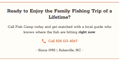
Two calls to action that match the style of the page and are easily noticeable but not intrusive. One is in the right column for desktop. The other appears at the bottom of the body copy for all visitors.
Trust Signals ("Licensed & Insured" and "Since 1985") are placed near each CTA action.
- With the client's approval, we'll often add newsletter sign-ups, tip sheets, or other lead magnets.
3. Development
• Mobile Optimization
- Navigation is keyword-rich and adapts seamlessly to any screen size.
- Every page is optimized for easy reading on mobile and desktop.
• Speed Matters
- Site speed is critical. Visitors abandon slow sites within seconds, and Google uses speed as a ranking factor.
- Our demo site scores highly in Google's PageSpeed Insights--proving that fast loading websites don't require bloated plugins or hosting tricks.

Responsive layout of home page on phones

Responsive layout of inside page on phones

Google Page Speed Insights scorecard
4. Marketing & Promotion
• SEO & Social Sharing Essentials
- Schema markup is a behind-the-scenes opportunity to tell search engines about the purpose of the site, features offered, pricing, reviews, and more. It also increases the chances of our site landing rich snippets (expanding the amount of information shown) on a search results page.
- Well-crafted meta titles and descriptions help our listing stand out on the search results pages--and "win the click."
- Open Graph and Twitter Card tags ensure that our brand looks professional when shared on social media.
- Bonus -
FishCamp is Powered by Our Custom CMS
"No Stress CMS makes updating our site simple and safe--I can change headlines, copy, and images without worrying about breaking anything."
-- A happy No Stress CMS user
No Stress CMS provides the following advantages over one-size-fits-all systems:
- Easy: update content with no technical skills.
- Flexible: manage headlines, images, copy, and links with a few clicks.
- Secure: no plugins, no theme conflicts, no databases, and no endless security and performance updates.
Is No Stress CMS the right content management system solution for your site? Let's find out! We offer a no-obligation, live demonstration.

Summary
This demo project proves that smart design, fast performance, and strategic content strategy can work seamlessly together--especially when powered by the right content management system.
If you're ready for a website that works hard to help build your business and is stress-free to manage, call us today for a free, no-obligation consultation. We'd love to hear about your goals and see if our website design services and No Stress CMS are the best fit for you: 828-551-9761
